Pacific Peak: Hawaii Couloirs
![]()
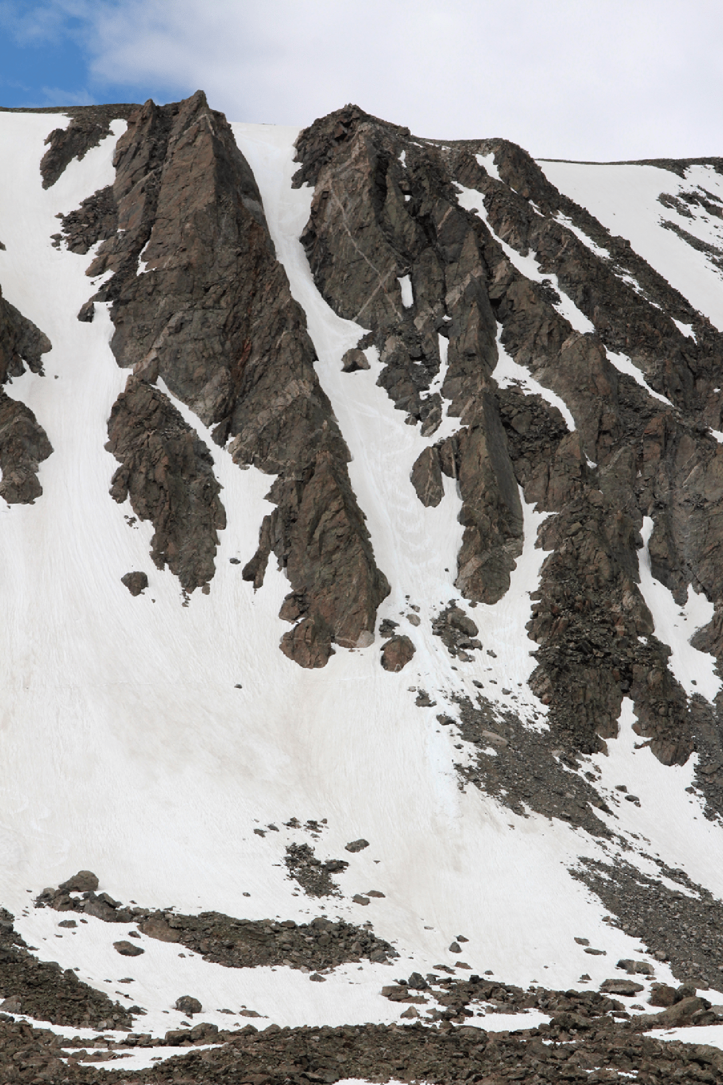
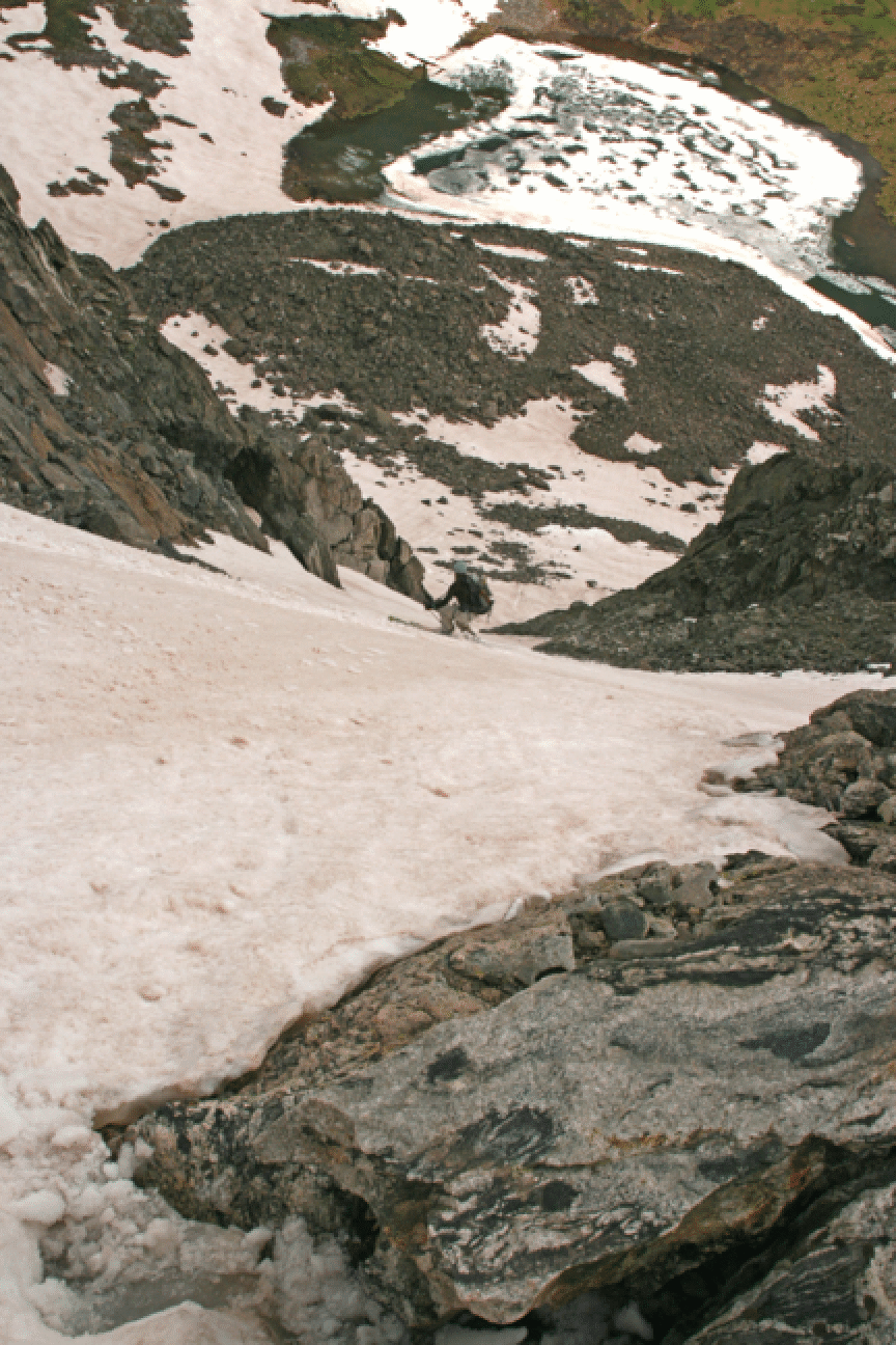
The north-facing couloirs from the high plateau of Pacific Peak (13950') into the Mohawk Lakes valley are steep and hold snow quite late. Three of them form the clear letters "HI", hence my name (also Hawaii is surrounded by the Pacific). For climbing, use the eastmost one (far left of the H, barely visible in this photo) or else the eastern lobe of the H. It is worth carrying on to the summit; the snowfield from the summit to the lake on the plateau is not steep, but provides clean skiing on generally firm snow. The couloirs themselves, which are called "borderline extreme" in Brian Litz's book, provide about 800 feet of fine skiing. In very warm weather the absolute eastmost line seems the most protected and is worth traversing to. In June 2000 I did the H with Leslie Ross. On June 24, 2001, Dave Blakeslee and I did this route to the summit in under 6 hours roundtrip. There is no need for skins this late in the season, as booting in the soft snow was fine.
June 12, 2005: On a very stormy day Chet Roe and I went to the top of the eastmost couloir and had a fine ski down, though the snow was not as firm as one would like. We had to fight very high winds on the approach, but once skinning up the couloir it wasn't too bad.
May 28, 2006: Bob Portmann, Daymon Pascual, and I booted up the H and then we each skied down different couloirs. My friends skied the two sides of the H, and I skied the easternmost run, not quite as steep but more sheltered from the sun and therefore the firmest of all three on a warm day. We managed to ski car-to-car on this day (some walking here and there), and learned something new about the approach. From the car (about 300 yards below the end of the road in summer), we headed left where the snow was continuous, and so avoided the trail by Continental Falls. This put us on some open slopes which provided good access to the upper valley and also, on the way down, some more fine skiing. Seven hours round-trip. Again this day we had very high winds in the main valley; one gust knocked us off our feet.
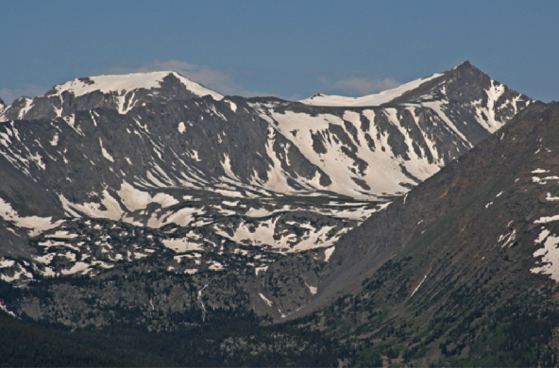
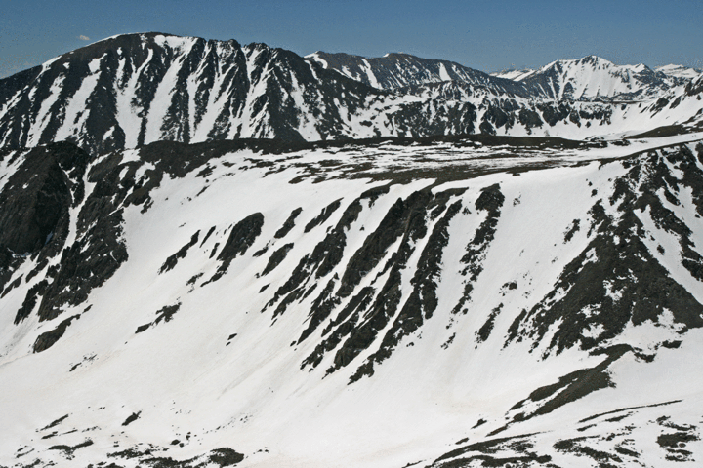
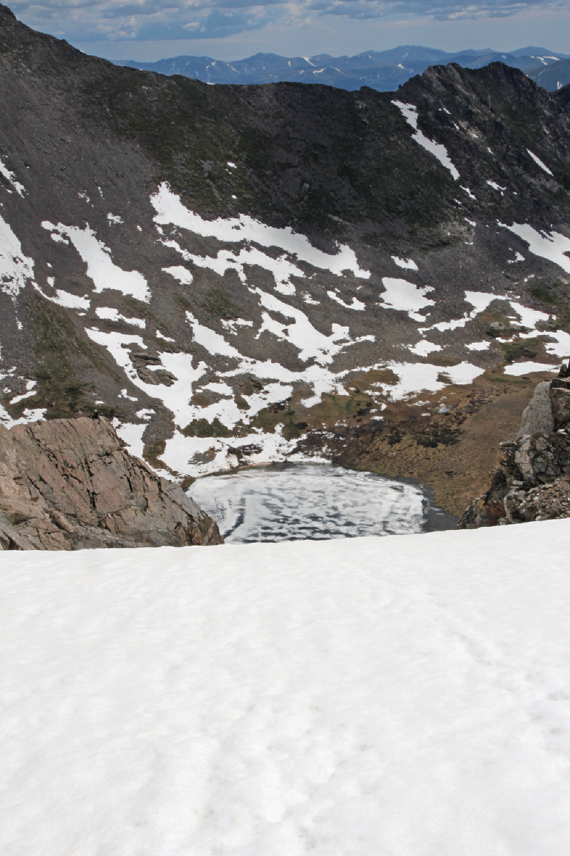
Here is a view from Baldy across the valley, taken June 22, 2007. The couloirs are prominently visible. I just learned that the beautiful lake just below the summit is the highest lake in the US. It has recently received the official name Pacific Tarn from the US Board of Geographic Names.
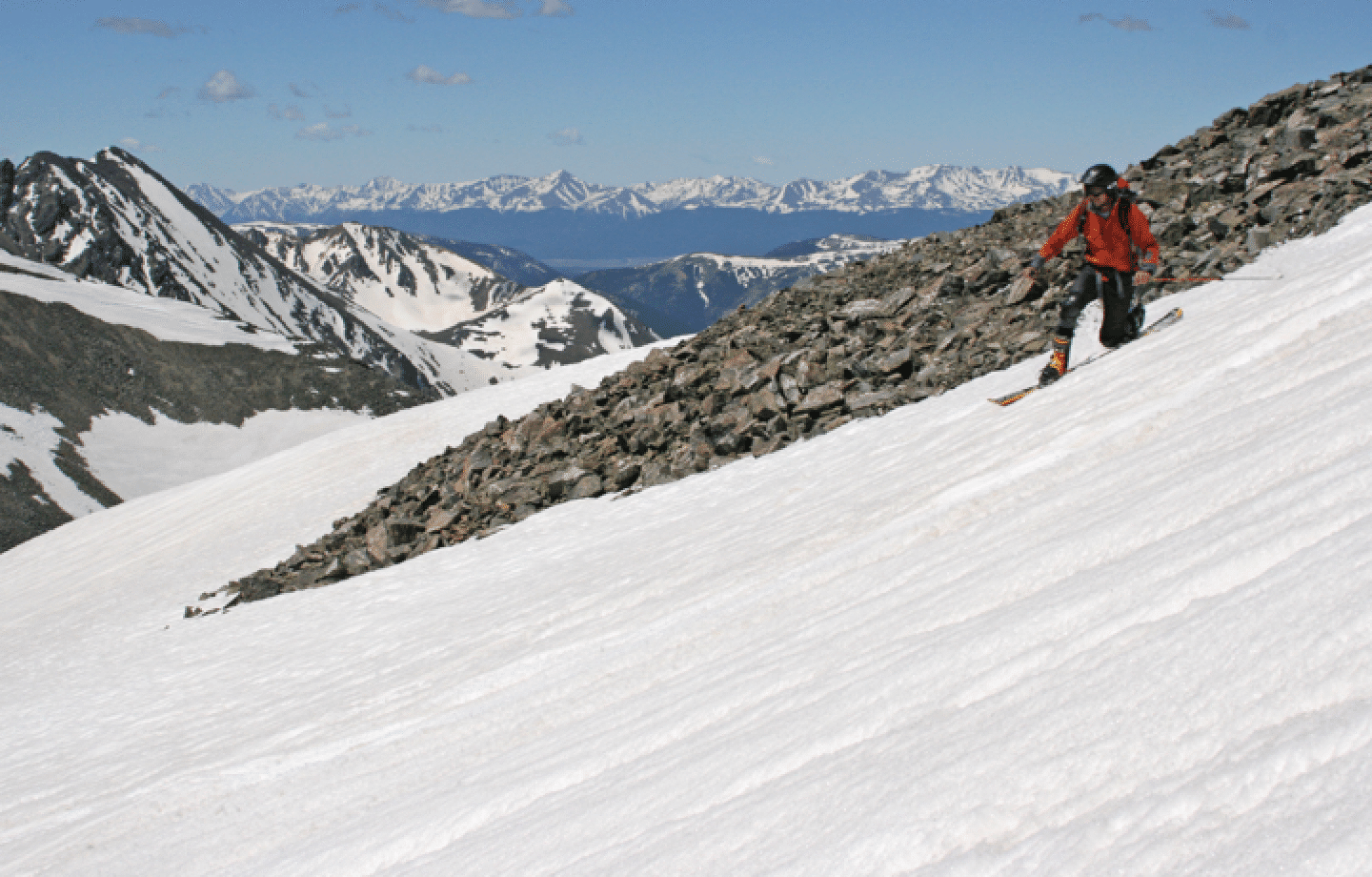
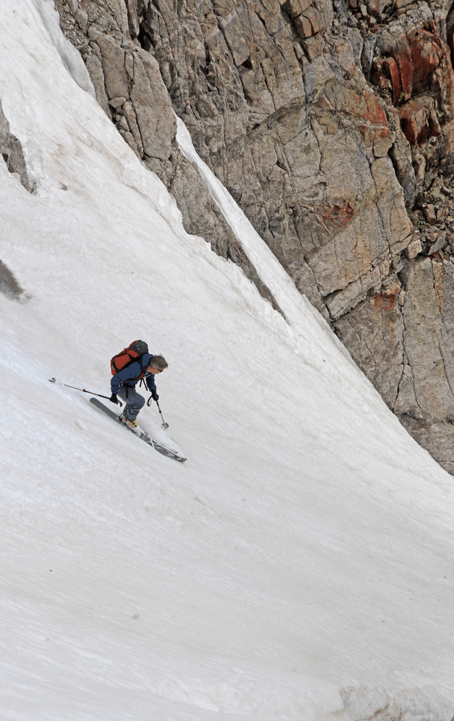
On June 21, 2008, Greg Ruckman, Sam Brede, Todd Beck, and I climbed the leftmost couloir (very nice conditions on the approach, and in the couloir) and continued to the summit. The descent was also in perfect conditions and we all descended the I. Best shots of the day were these of Greg: first by me, second by Sam with my camera. The first one is one the mellow upper face, just leaving the high summit. The peak at rear left is Drift, with its famous ski line visible.
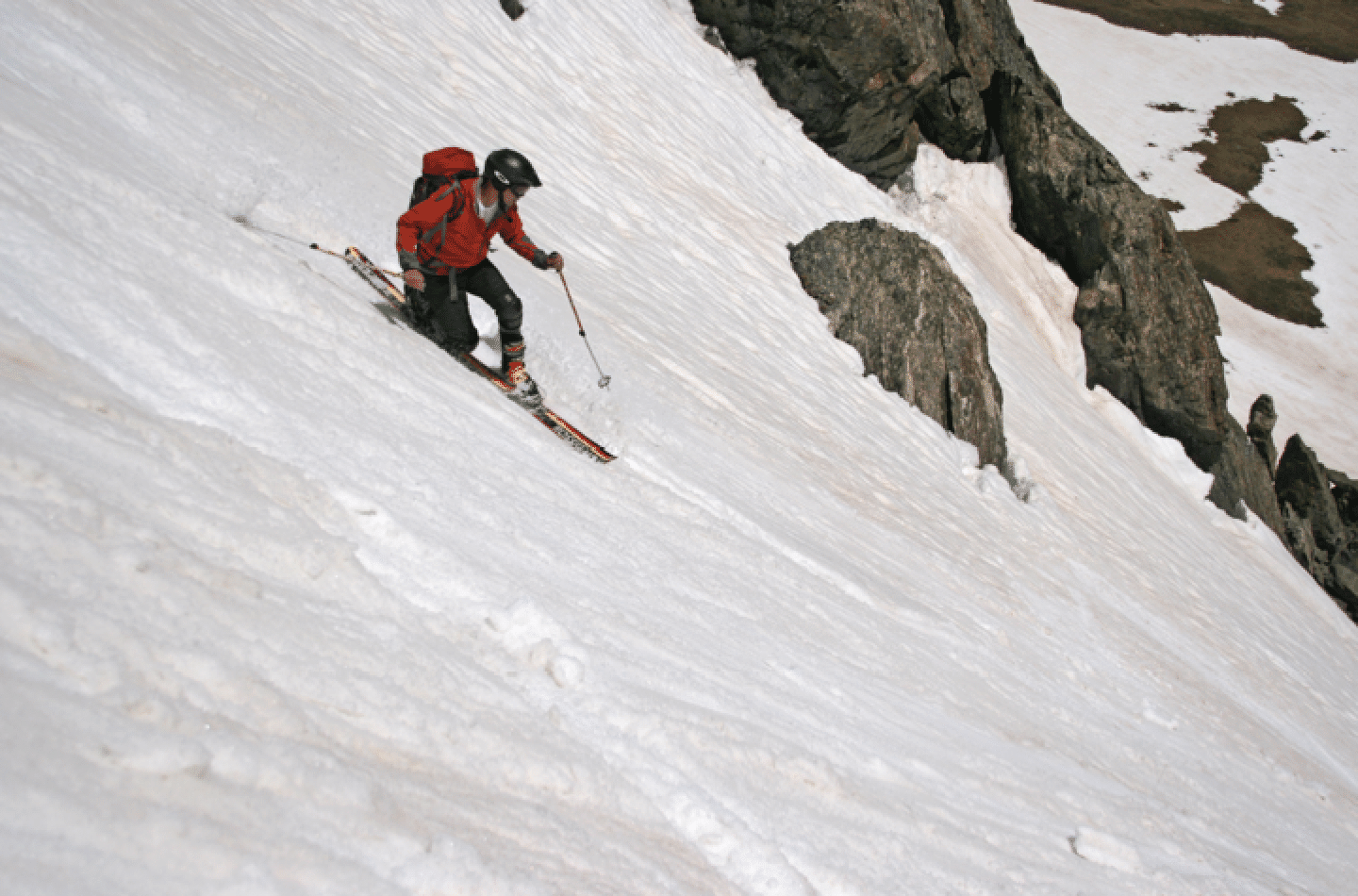
And Greg halfway through the I couloir.
On July 2, 2009, Elke Dratch and I climbed the usual way and descended the "I" couloir. Conditions were fine. Here is Elke in the heart of it.
And looking up:
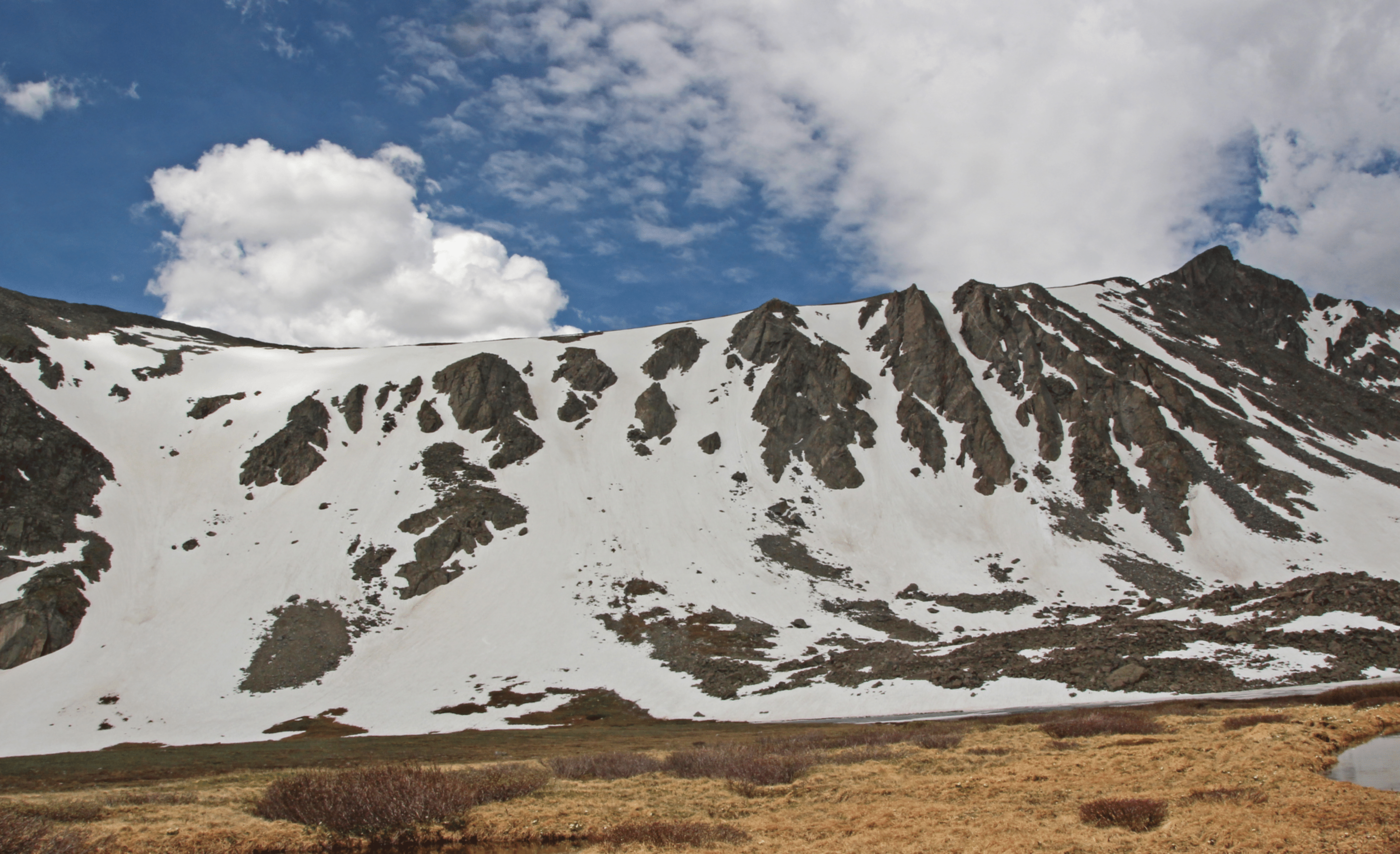
And a nice view from Crystal on June 10, 2011. The Pacific Tarn, the highest lake in North America, is visible above the Hawaii Couloirs.
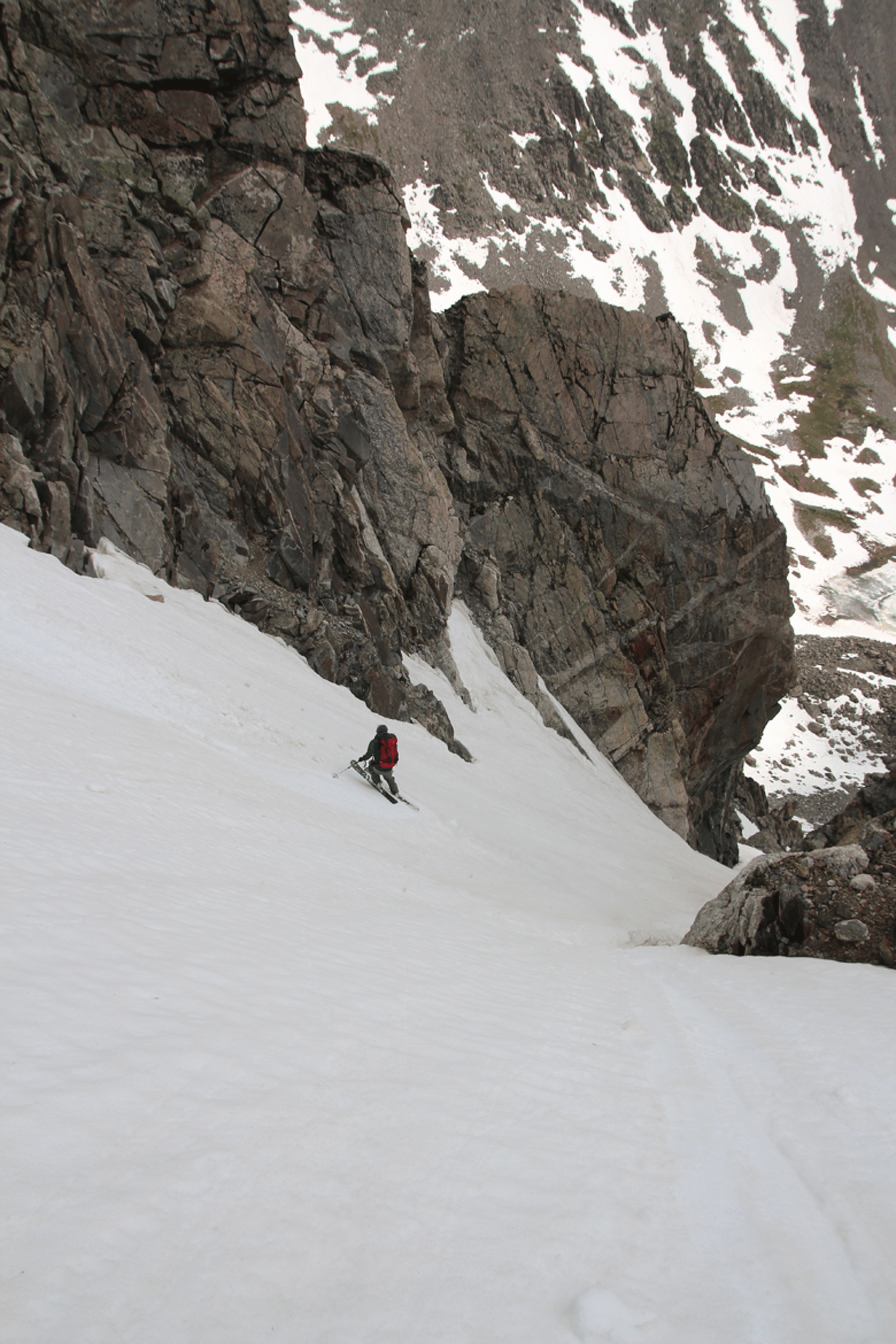
On June 28,2015, Randy Garrison and I marked the end of the season by skiing a Hawaii Couloir. Snow cover in the valley was very low, so there was lots of walking. We booted up the steep eastmost face as usual. Then we skipped the summit and headed for what I thought was the “I” couloir. But in fact it was the steep and narrow one just west of “I”. It was slushy but ok. We had to walk to the base of steep snow climb, but it took only two hours. Quite pleasant. (Photo by Randy Garrison)

Here is the whole face. We skied the very straight couloir well right of center.
At the start of it.
Randy at the start.
Randy in the guts of it. It was quite steep and narrow.
A look back at the interesting line.