Arkansas, Northwest Face and Moonshine Couloir
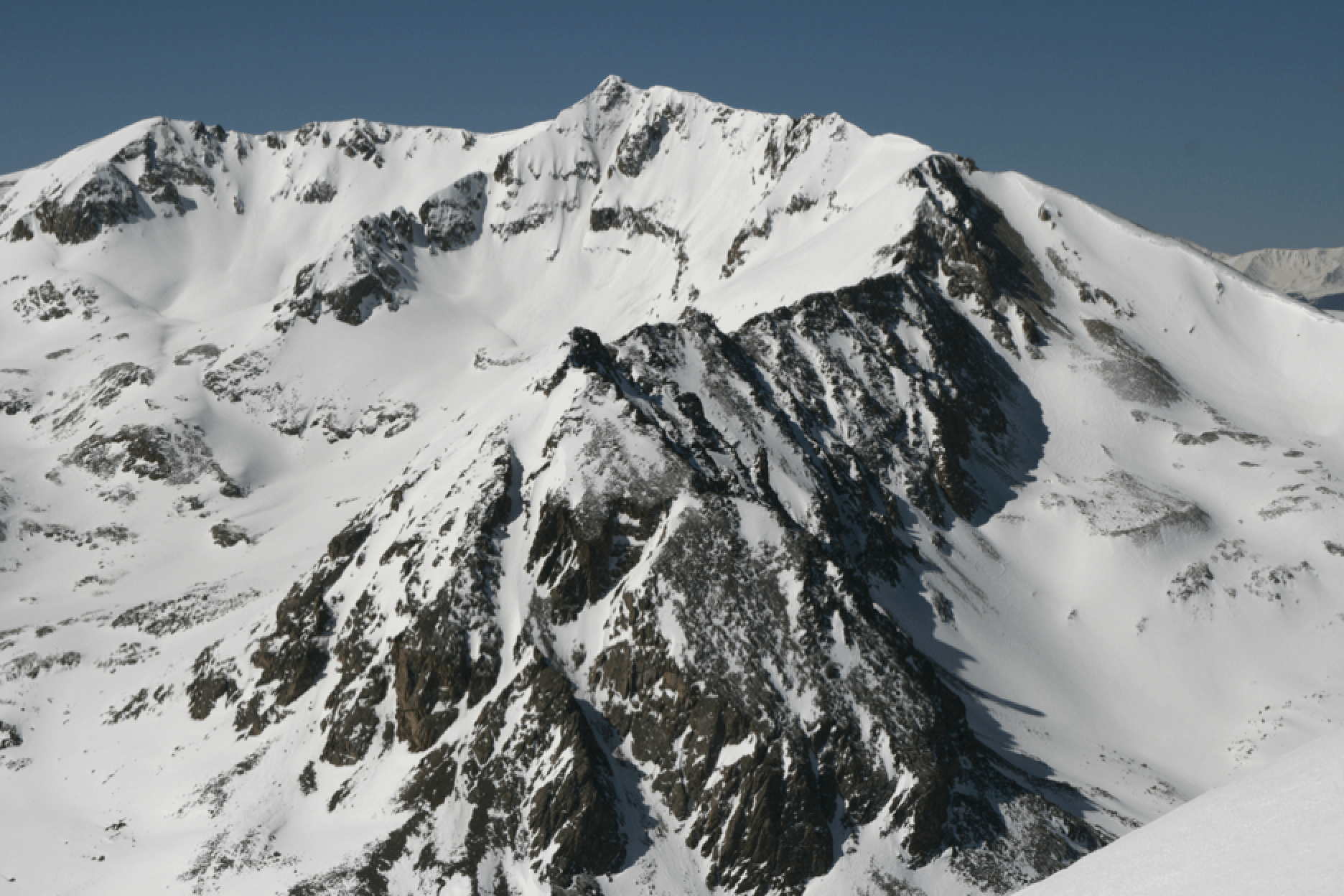
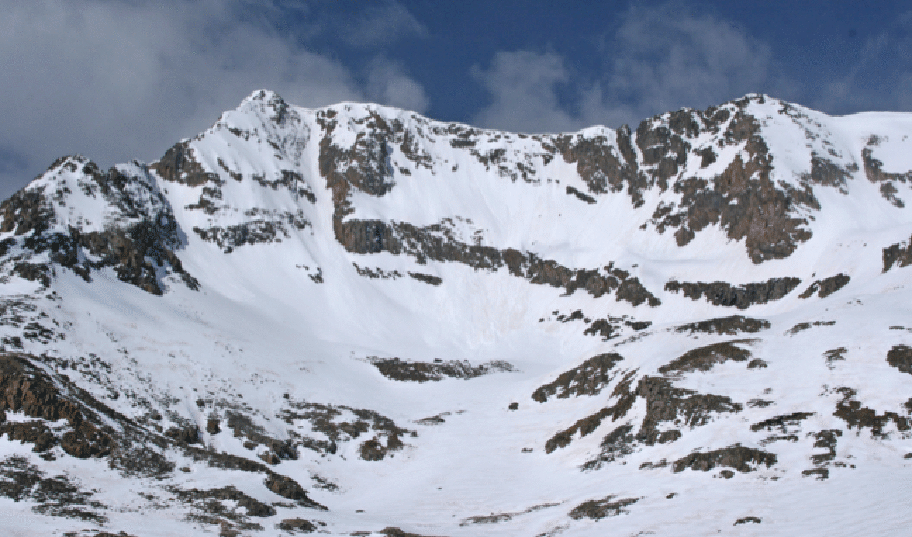
Here is a nice view of the whole north side of Mt. Arkansas, taken from the ridge of McNamee, April 10, 2011. The oft-skied NW face is on the right. The crazy-steep couloir from the summit comes down just lookers right of the summit, and a gentler descent from the summit area starts near the large cornice just lookers left of the summit.
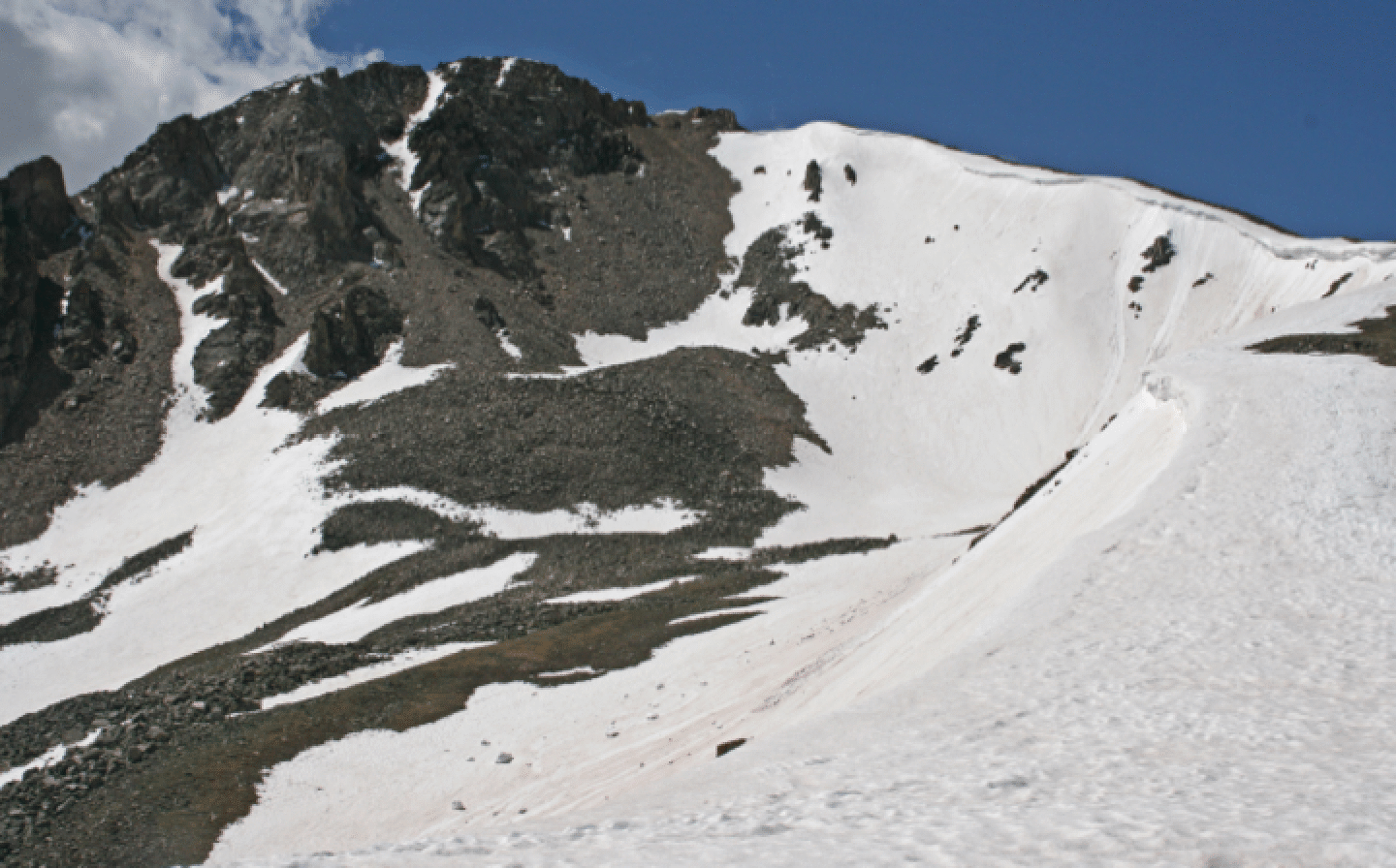
You can't beat this one for easy access: take the dirt road on the left (heading from Copper) just after the Climax mine operation south of Fremont Pass. Drive about a half-mile, park, and head south into the valley and then up the ridge forming the west side of the bowl. The ski slope, which starts at about 13200, is visible from the highway at Fremont Pass. It is steep (50 degrees) at the top but eases quickly. Photo above taken en route to the shoulder on June 19, 2008.
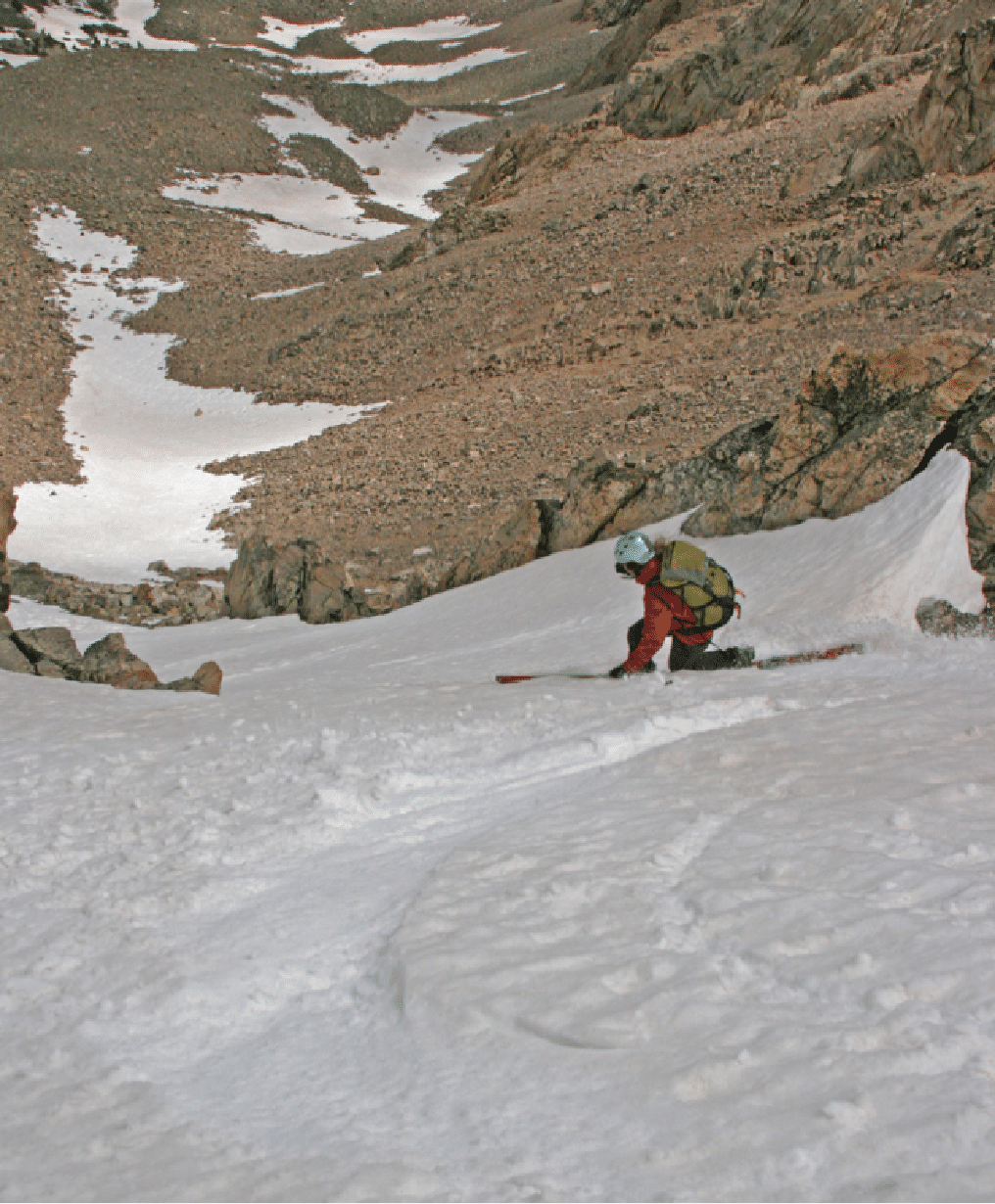
I first skied this on June 17, 2001, with Dave Blakeslee. Recent snow made conditions less-than-perfect for June, but we enjoyed them anyway. A difficulty in photographing skiers is keeping the camera horizontal. The horizon helps, but often an image must be rotated and cropped to get the realistic angle. At the spot shown below -- the skier is me -- near the start of the skiing, the slope is near 50 degrees. Photo by Dave Blakeslee.
Like all steep slopes, this one avalanches from time to time, and it did so in May 2005. While skiing in the valley below on light touring gear after that, we were surprised by a Leadville policeman who approached us as we reached our car. Was he going to criticize our parking choice? Not at all. He just wanted to tell us about the avalanche and make sure that we were aware.
June 5, 2007: Aaron Parmet, Elke Dratch, and I skied it. There was new snow and it felt more wintry than spring. We were able to ski down to very near the dirt road by staying right, but the low snow was not very solid and nasty in spots.
![]()
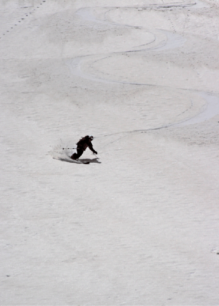
June 19, 2008. Started late with Greg Ruckman and Maggie Geddes. The face was quite mushy, but still skiable. Coverage was fine and we could descend on skis very close to the car. The two pics below show Maggie, who skied gracefully even in the slushy conditions.
From the summit of Arkansas there descends a remarkable couloir (just right of summit in photo). It is very prominently seen from the high peaks of Breckenridge. Here is a shot taken in mid-May 2009. It has been skied; there is a giant cornice at the top.
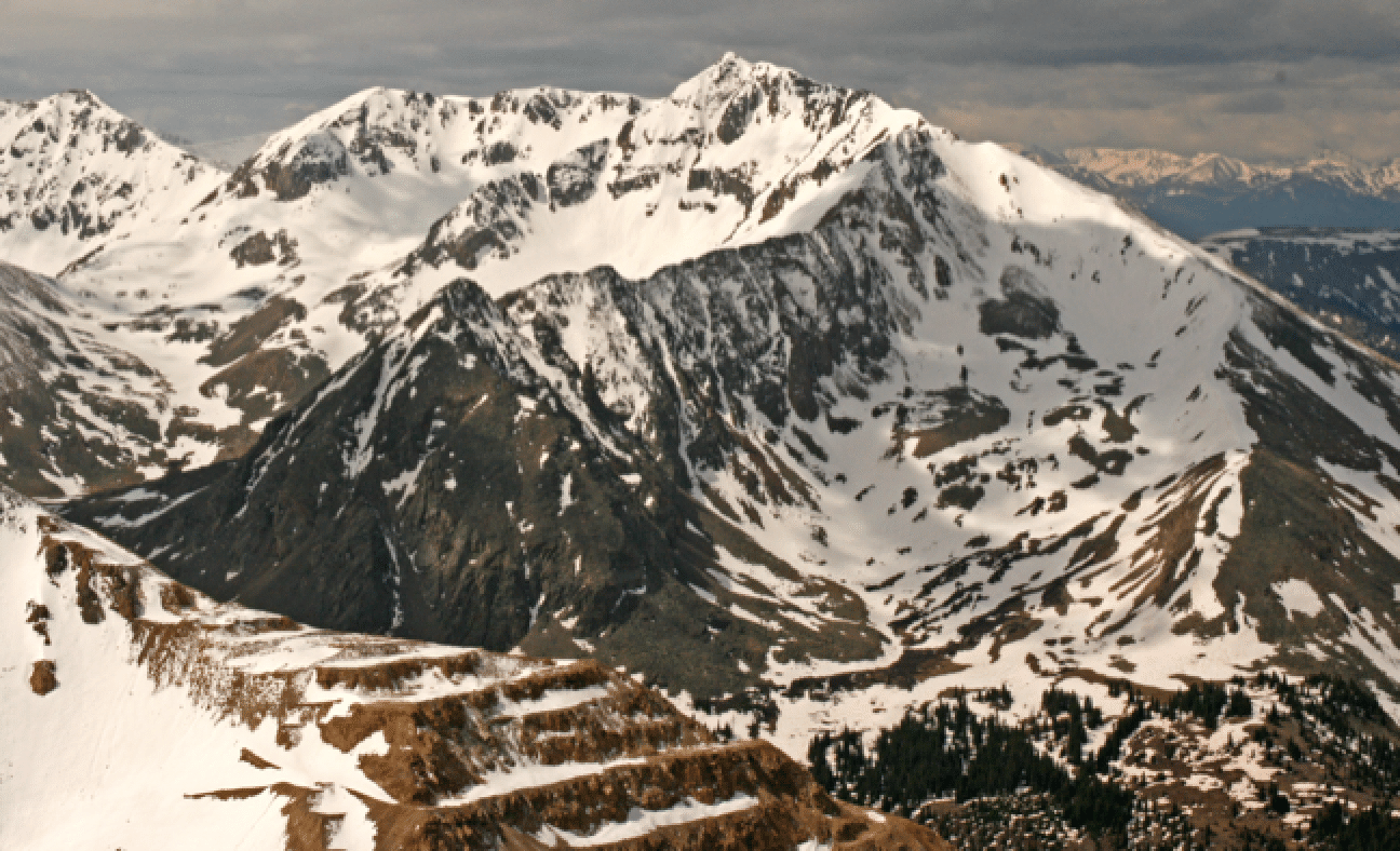
And on June 14, 2009, Jonathan Kriegel, Todd Beck, and I skied the NW Face, this time descending the couloir that is farthest to looker's left. It was icy at the top, but the valley had lots of snow and we could ski almost back to the car. Here is a photo of the face taken on June 12, 2009, from Bartlett summit, with mine terracing prominent in foreground.
The photo above shows the Arkansas-Tweto saddle at far left. On June 5, 2011, I skied solo up to it (kicking steps for last couple hundred feet) and had a fine ski down. And in May 2013, Elke and I did the complete circumnavigation of Arkansas, with its gentle route all the way to AT Col (Arkansas-Tweto), the steep ski down the E side, and then a very short climb (no skins) through “Skaters Saddle” and down to Climax Corner.