Sayres Peak, X Rated
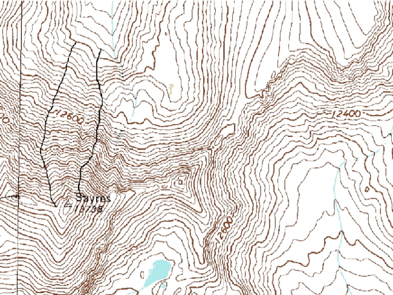
It can be instructive to compare the flat world of a topo map with the 3-dimensional reality. The black lines on the map below show Grand Central Couloir (left) and X Rated.
![]()
And the three-dimensional view:
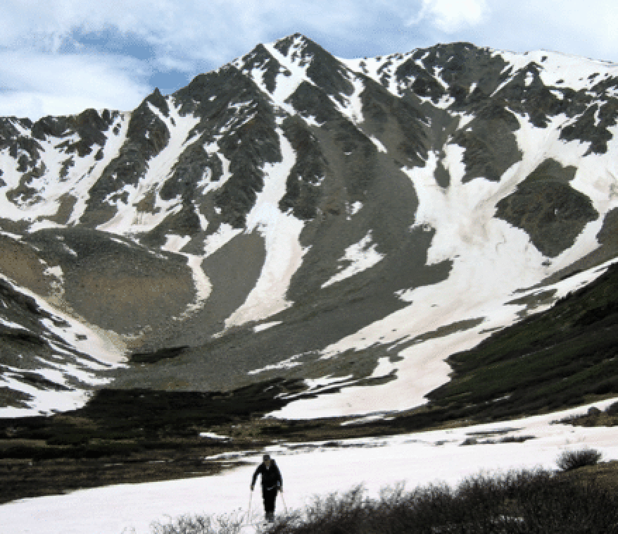
![]()
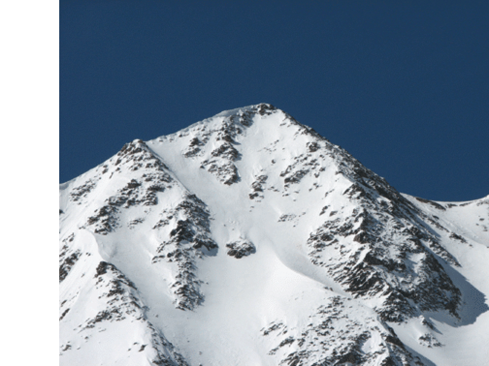
The beautiful valley and face on the north side of Sayres (La Plata is to the left in this photo). From the summit (above my head), the X is prominent. We entered on the east branch, turned right at the cross of the X, and then kept right, dealing with the rock crossing. Note all the options one would have with better coverge: Maybe start at the true summit; at the X's cross go straight; or, probably the best, turn left before the location of the rock band (see photo of Grand Central Couloir -- even in good conditions, the rock band area might pose problems). All photos by Katie Larson. I carried my camera but the battery was at home.
![]()
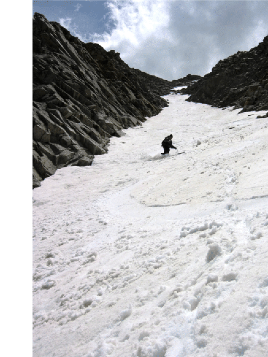
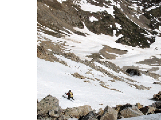
Stan finally making some comfortable turns in the lower 1000 feet, with the rock section visible above. The little snow patch above the rock was not actually part of the ski route, which is hidden to the right.
![]()
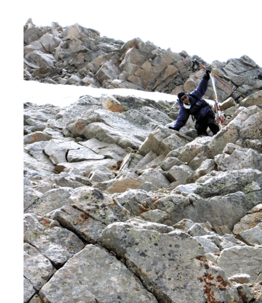
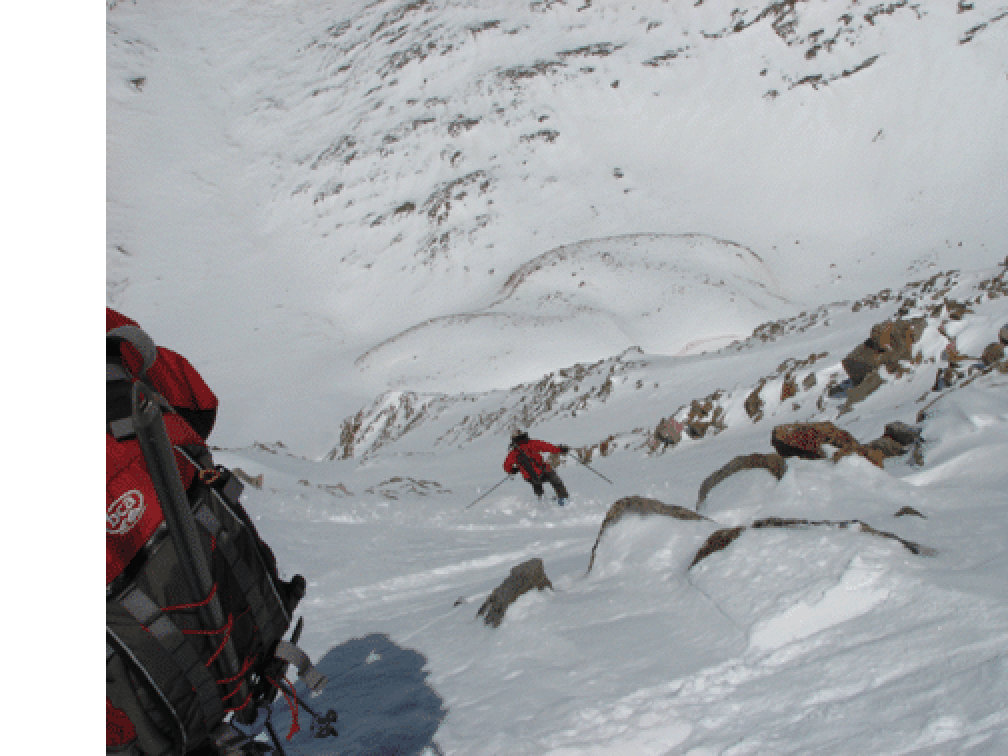
Dealing with the rock band. Class 3 is not hard climbing, but with ski boots on the feet and skis and poles in the hand, it gets your attention.
June 10, 2006. Katie Larson and I wanted to ski Grand Central Couloir. But our first view after hiking up the first part of the La Plata Trail was depressing, as the route was more scree than snow. Clearly we had missed the snow train in Grand Central. What to do? Well, the answer was obvious from Katie's point of view, as there was only only skiable line from the summit. I was well aware of it (see my comment about "the enthusiast" at end of Grand Central section), but it looked steep in the best of conditions, and these were not the best of conditions. Moreover, there would be a rock-scrambling section to connect the skiable parts.
Well, up we went. After all, who wants to carry skis and boots so far and not use them. We gained the saddle on the W side with no problem and carried on to the summit (just under 5 hours). The drop in to the top of the east branch of the X, which is just east (looker's left) of the summit (which itself is the leftmost bump), wasn't bad. Indeed, the upper section is not all that steep, but the entire line does not let up, and it got slushier the lower we went. Then we had to carry our skis down about 100 vertical feet on loose rock to get to the top of the last 1000-foot section. Well, this should have been excellent, and it was in fact fine, but the slushiness led to small avalanches that one had to pay a little attention to.
Anyway, we did it. Of course, one should do this when the coverage is better and there are some other options as to how to finish after one passes through the center of the X. Some map work shows that the upper 1000 feet averages 40 degrees. In June, 2005, Dave Bourassa and Mark Caveillero skied X-Rated, with Dave dropping in from the very summit, which he reported at 48 degrees; see <<http://www.tetongravity.com/forums/showthread.php?t=31345>>. They approached via the mining roads on the W side, starting at 3 am and summitting at 8 am.
I guess another good reason for my choice of name is that this line would be at least a D10 on the difficulty scale (http://wildsnow.com) -- and also R3 on the risk scale. Perhaps D11 is appropriate if one takes the steeper entrance.
One last shot: Here is Mark Caveillero about halfway down in excellent conditions (2005). (Photo: Dave Bourassa)
![]()
And more updates. This face is starting to get lots of attention. Here are two photos from a trip by Andy Dimmen, Derek Drechsel, and Brian Kalet on April 28, 2007. They skied from the summit, and entered the north face on the west side. the second photo below shows Brian Kalet in action on the very steep uppermost section of this run. After consulting with Dave B., it seems best to have just one name for this general line. So the true "X-Rated" goes from the summit and rates D13. The easier entrance about 100 yards to the east of the summit rates D10. These two photos are by Andy Dimmen.
![]()